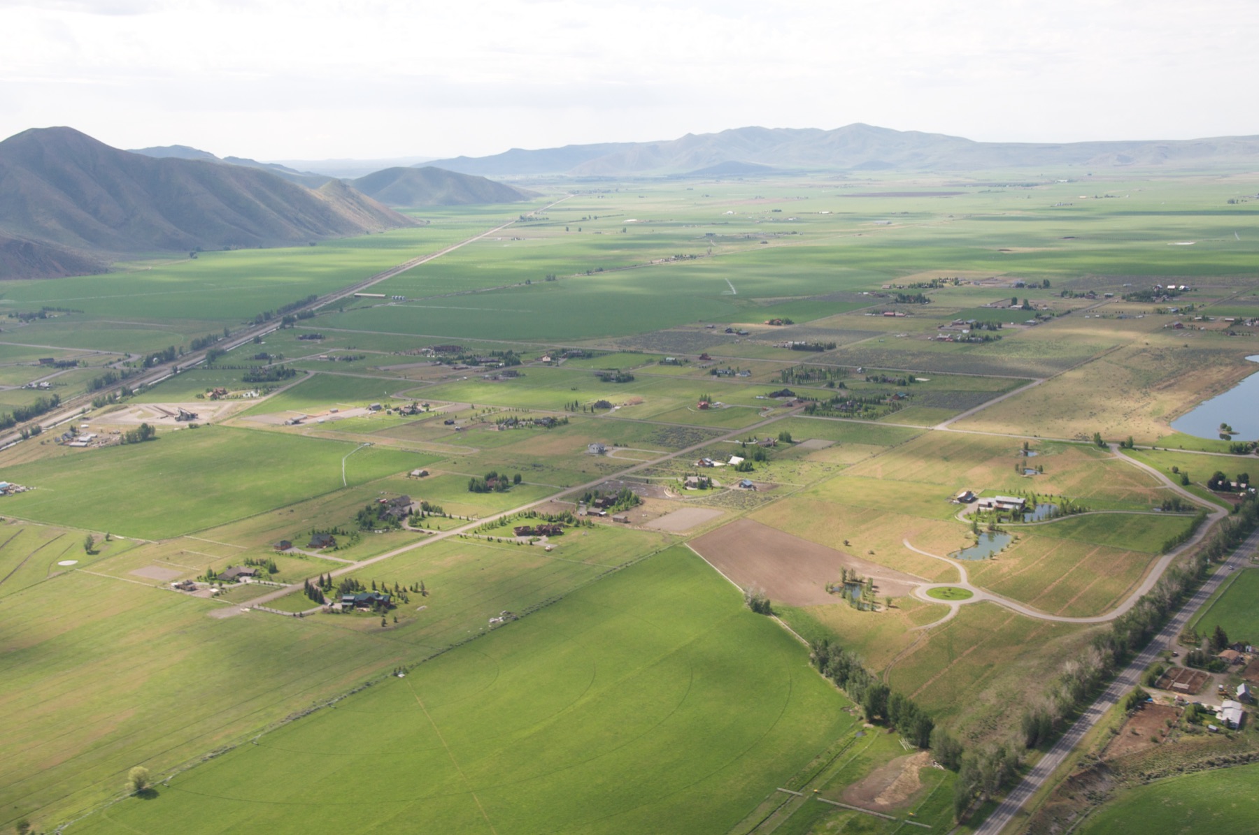
Parcel and surrounding context
Location, surrounding land conditions, nearby features, land cover, aerial interpretation, and the basic setting that frames the review.
Pre-decision land intelligence
A Land Decision Brief is a fixed-scope parcel review for early decisions. It helps answer what the land appears to be telling you, what deserves attention first, and what should be verified before a buyer, advisor, lender, builder, or land steward commits more time or capital.
The problem
Floodplain maps, wetlands indicators, soils data, slope, access, aerial imagery, and zoning context may all exist, but they rarely arrive as one clear read of the parcel. The Land Decision Brief organizes those fragments before a decision moves too far on assumption.
What you get
Location, surrounding land conditions, nearby features, land cover, aerial interpretation, and the basic setting that frames the review.
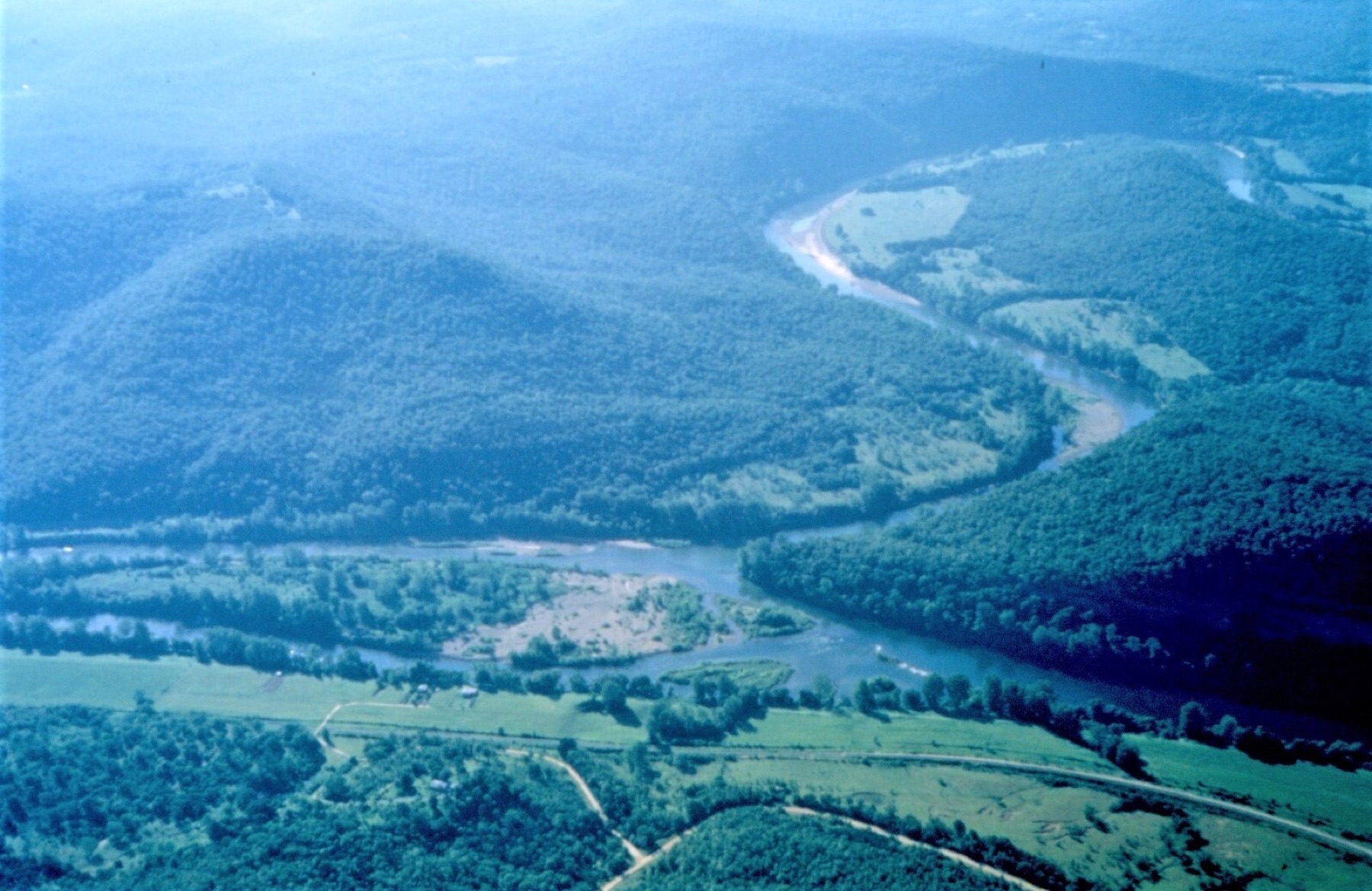
Mapped floodplain position, nearby water features, drainage context, wetlands indicators, soils information, and conditions that may need verification.
Slope, landform, low areas, apparent access, frontage, road context, mapped constraints, and questions that may require local confirmation.
Structured findings, likely caution areas, Known / Unknown / Verify framing, and a proceed / proceed with caution / avoid recommendation posture.
Who it is for
For land buyers, rural acreage buyers, conservation buyers, restoration buyers, and land stewards who need an early read before purchase terms or deeper diligence begin to harden.
For rural realtors, brokers, attorneys, estate planners, and lenders who need readable parcel context before a file moves deeper into review, financing, transfer, or planning.
For builders, site professionals, and project teams evaluating whether terrain, water, access, or surrounding constraints may affect intended use.
Service options
$249–$495
24–48 hour turnaround
A fast, high-level scan to identify major concerns before a parcel moves further into consideration.
Best for early red-flag screening.
$950–$1,750
3–5 day turnaround
A full structured parcel analysis with findings, constraint context, and recommended next steps.
Best for most pre-offer parcel decisions.
$2,500–$5,000
5–10 day turnaround
Deeper analysis with more detailed interpretation and intended-use considerations.
Best for complex parcels, higher-stakes purchases, or intended-use questions.
Final scope depends on parcel complexity, available data, intended use, and requested turnaround. Price ranges are planning ranges, not guarantees.
Add-on services
$500–$2,500+
Scoped by site and flight needs
Site-specific aerial imagery with annotated observations, used as supporting visual intelligence where current imagery matters.
Custom pricing
Scoped after purchase or project definition
Post-purchase support for long-term land understanding, management context, and reviewable map records.
How it works
Share the parcel location, intended use, decision timeline, and any documents or questions already in hand.
Aegis Geospatial reviews available public and parcel-relevant data against the decision question.
Findings are organized into a structured written brief with map-led context and follow-up questions.
You receive a clear report with findings, limitations, and a practical proceed / caution / avoid posture.
Important limitations
The Land Decision Brief is a preliminary intelligence product based on public data, available parcel information, and professional interpretation.
It is not a survey, legal opinion, engineering report, wetland delineation, permitting determination, or guarantee of parcel suitability.
Why Aegis Geospatial
Aegis Geospatial helps organize parcel, terrain, water, and constraint information before a buyer, advisor, or project team moves into formal due diligence. The goal is a clear early read: what appears workable, what appears constrained, and what should be verified before the next commitment.

Submit parcel details, intended use, and decision timeline to begin scoping the right level of review.